Drone Thermal Imaging & Inspections | Infrared Aerial Solutions
Professional drone thermal imaging services for construction, surveying, and infrastructure inspection. High-precision thermal mapping and analysis.
What is Drone Thermal Imaging
Thermal imaging drones are transforming industries by providing critical insights that are invisible to the naked eye. Equipped with advanced infrared sensors, these drones can detect heat signatures, measure temperature variations, and create detailed thermal maps. From inspecting solar panels to identifying roof leaks, thermal imaging drones offer unmatched efficiency, safety, and accuracy. Businesses across energy, construction, agriculture, and emergency services are increasingly relying on this cutting-edge technology to save time and reduce costs.
How Drone Thermal Cameras Work
A drone thermal camera captures infrared radiation emitted by objects and converts it into a visual image called a thermogram. Warmer objects appear in brighter colors, while cooler areas show in darker shades. This heat mapping capability allows operators to quickly identify anomalies such as overheating equipment, water infiltration, or hidden structural issues. Modern drones combine thermal sensors with high-resolution RGB cameras, enabling side by side comparison of visual and thermal data for precise measurement and reporting.
Industrial Applications of Thermal Drone Inspections:
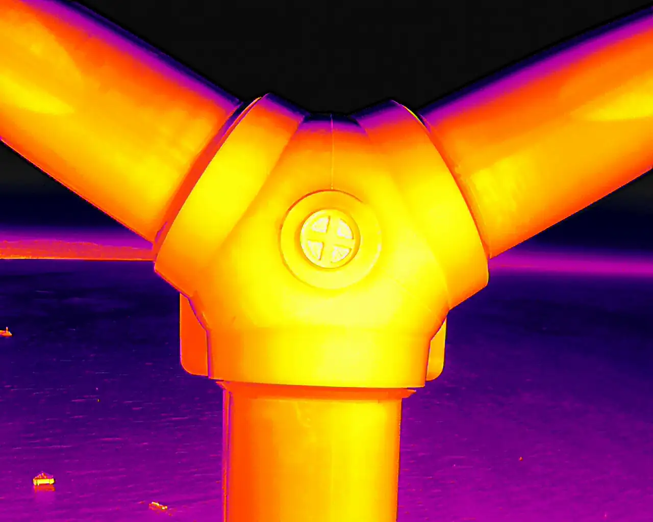
Energy Sector
In the renewable energy industry, thermal drones play a vital role in solar panel inspections. Faulty cells and damaged connections generate abnormal heat signatures, which thermal imaging can quickly pinpoint. Wind turbines and substations also benefit from aerial thermal inspections, helping maintenance teams detect overheating components before they fail.
Construction and Building Inspections
Thermal imaging drones help construction professionals detect insulation gaps, air leaks, and hidden moisture in walls and roofs. This allows for proactive repairs, improved energy efficiency, and reduced heating or cooling costs. For roofing contractors, drones provide a safe and cost-effective alternative to manual inspections, delivering accurate thermal measurements without the risks of climbing.
Agriculture and Environmental Monitoring
In agriculture, drones equipped with thermal cameras measure crop health, identify irrigation issues, and detect livestock. Heat variations in fields highlight areas of stress, guiding precision farming techniques that improve yield. Environmental agencies also use thermal drones to monitor wildlife, locate forest fires, and study habitat changes.
Emergency and Search & Rescue Operations
Thermal drones have become indispensable tools for firefighting and disaster response. They can locate hot spots in burning buildings, track wildfire spread, and identify survivors in smoke filled or dark environments. In search and rescue, thermal cameras detect body heat, drastically improving the chances of finding missing persons quickly.
Advantages of Drone-Based Thermal Measurement
Using drones for thermal imaging delivers several key benefits:
- Safety: Reduce the need for workers to climb, enter hazardous zones, or operate heavy machinery.
- Speed: Cover large areas quickly with real-time thermal data.
- Accuracy: Pinpoint issues with precise temperature measurements and detailed thermal maps.
- Cost Saving: Minimize downtime, reduce manual labor, and extend equipment lifespan with early fault detection.
Conclusion
As industries demand smarter, safer, and more efficient solutions, drone thermal imaging and measurement are proving to be game changers. With applications ranging from energy audits to emergency response, the ability to visualize and measure heat data from the air opens endless possibilities. Businesses that adopt thermal drone technology gain a competitive edge, delivering higher quality services while saving time and money.