Orthomosaic & 3D Modelling
Transforming Aerial Data into Accurate, High-Resolution Maps and 3D Models for Informed Decision-Making
Unlocking the Power of Drone Orthomosaic Mapping and 3D Modelling
Drone technology has revolutionized the way industries capture and analyze data. With advanced sensors and high resolution cameras, drones now provide precise aerial imaging that can be processed into orthomosaic maps and 3D models. These tools are invaluable across construction, agriculture, real estate, mining, and environmental monitoring. By leveraging drone mapping, businesses gain accurate insights faster, safer, and at a fraction of traditional survey costs.
What is Orthomosaic Mapping?
Orthomosaic mapping uses thousands of drone captured images stitched together to create a single, highly detailed, and georeferenced aerial map. Unlike standard aerial photography, an orthomosaic map is corrected for perspective and distortion, providing true to scale measurements. This makes it a powerful tool for land surveying, infrastructure inspection, and precision agriculture. Businesses can measure distances, areas, and volumes directly from the map, improving decision making and reducing the need for ground surveys.
Real-World Applications of Orthomosaic Mapping
By integrating drone orthomosaic mapping into workflows, organizations save time, reduce costs, and improve operational efficiency.
- Construction & Infrastructure: Monitor site progress, track materials, and validate contractor work with centimeter level accuracy.
- Agriculture: Assess crop health, plan irrigation, and optimize yields with NDVI and multispectral mapping.
- Environmental Monitoring: Track erosion, flood zones, and land use changes over time.
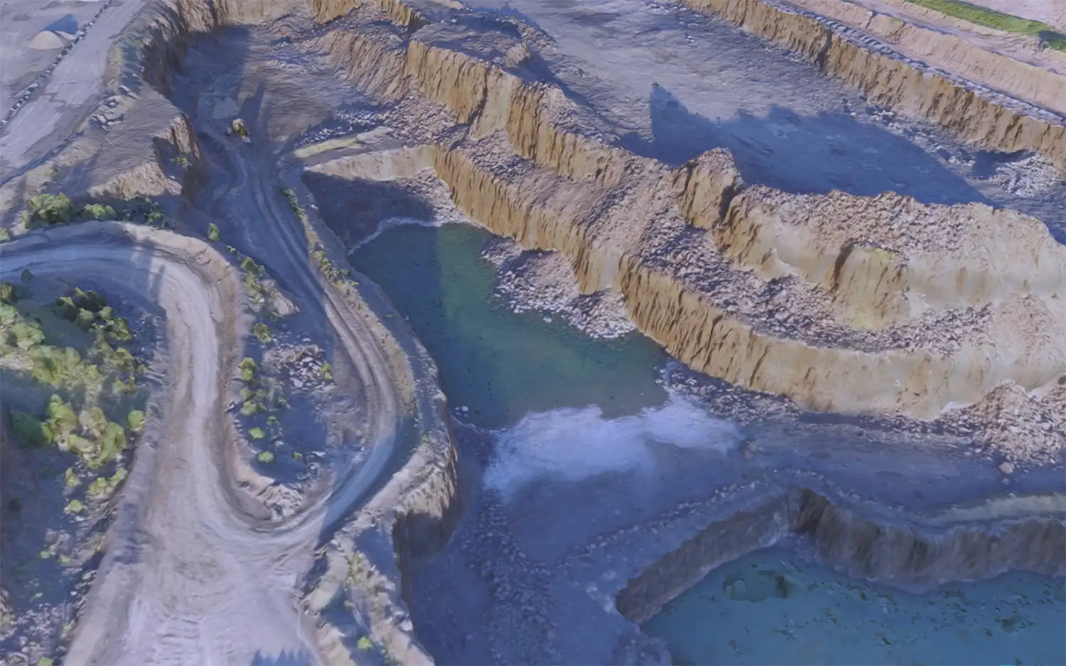
- Mining & Quarrying: Measure stockpile volumes, monitor site safety, and optimize operations with accurate topographic data.
What is 3D Drone Modelling?
3D modelling takes drone data a step further by transforming aerial imagery into detailed digital models. Using photogrammetry, drones generate 3D reconstructions of terrain, structures, and objects. These models provide realistic perspectives that can be explored, analyzed, and shared with stakeholders. Unlike flat maps, 3D models reveal height, depth, and spatial relationships, giving a complete picture of the surveyed area.
Real World Applications of 3D Drone Models
3D drone models not only improve accuracy but also enhance communication by presenting data in a visually engaging format.
- Architecture & Real Estate: Create immersive visualizations for clients and investors, showcasing buildings and landscapes in stunning detail.
- Engineering & Urban Planning: Simulate infrastructure projects, detect potential conflicts, and visualize future developments.
- Roof & Structural Inspections: Replace risky manual climbs with safe, detailed 3D roof models for maintenance planning.
- Cultural Heritage & Archaeology: Digitally preserve historical sites with millimeter precision for research and restoration.
The Competitive Edge of Drone Mapping
Combining orthomosaic maps and 3D models equips businesses with actionable data to streamline projects, reduce risks, and improve collaboration. Clients and stakeholders gain confidence from transparent, measurable results. Industries adopting drone mapping consistently report increased productivity and reduced overheads compared to traditional survey methods.
Conclusion
As industries continue to adopt digital solutions, drone orthomosaic mapping and 3D modelling stand out as indispensable tools. From precision agriculture to construction and beyond, these technologies provide accurate, scalable, and cost-effective solutions. Companies that embrace drone mapping gain a competitive advantage through better data, faster insights, and safer operations.