Construction Progress Monitoring
Communicate project progress to stakeholders with images and timelapse video
Introduction
The construction industry has always relied on accurate documentation to track progress, ensure safety, and maintain efficiency. Traditionally, site managers depended on manual inspections, photography, and written reports. Today, drone images and video are revolutionizing construction progress monitoring by providing fast, precise, and cost-effective aerial insights. By capturing high-resolution images and real-time video footage, drones give project stakeholders the visibility they need to make informed decisions at every stage of development.
High Resolution Aerial Photography for Documentation
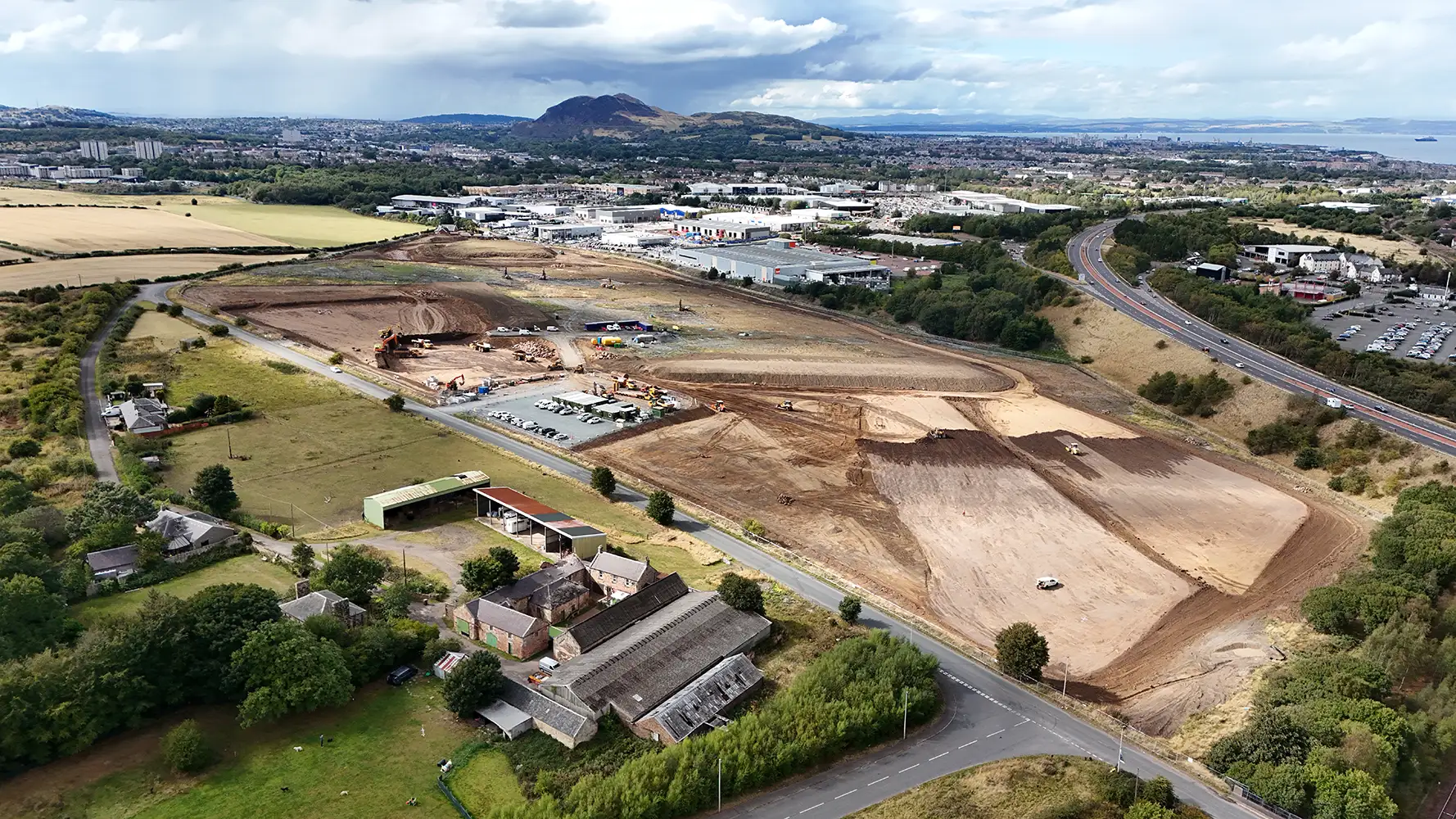
Drone images deliver crystal-clear aerial perspectives of construction sites, offering documentation that is far superior to ground-level photography. With consistent flight paths, drones can capture progress from the same vantage points each week or month, creating a visual timeline of development. This makes it easy to showcase milestones, identify potential delays, and share progress reports with clients, investors, and project teams. High resolution drone photography also reduces disputes by providing verifiable, time stamped evidence of site conditions.
Real Time Video for Project Oversight
Drone video adds another layer of oversight to construction progress monitoring. Live or recorded aerial footage allows project managers to see the entire site in context, making it easier to coordinate workflows, identify hazards, and verify that subcontractors are working according to plan. Drone video can be streamed remotely, enabling off site stakeholders to track progress without needing to travel. This not only saves time but also improves collaboration across teams and reduces the risk of miscommunication.
3D Mapping and Site Modeling
Beyond standard photography and video, drones equipped with advanced sensors can generate detailed 3D maps and site models. These digital models provide accurate measurements, volumetric analysis, and elevation data that help with earthworks calculations, material tracking, and design validation. By integrating drone data into Building Information Modeling (BIM) software, teams gain powerful tools to compare design plans with real-world progress, ensuring alignment throughout the project lifecycle.
Enhancing Safety and Efficiency
Monitoring construction sites with drones is not just about progress tracking—it also enhances safety and efficiency. Instead of sending staff into potentially hazardous areas, drones can quickly capture images and video from above. This reduces the need for scaffolding, ladders, or manual surveys, lowering the risk of accidents. Drone technology also speeds up the inspection process, allowing teams to collect comprehensive site data in minutes rather than hours.
Improved Communication with Stakeholders
Clear communication is essential in construction projects, and drone imagery provides a powerful visual tool for keeping stakeholders informed. Regular drone images and videos make it easy to create professional reports and presentations that clearly show project status. Whether it’s updating clients, coordinating with architects, or managing subcontractors, aerial visuals provide a common reference point that everyone can understand.
Conclusion
Drone images and video are transforming construction progress monitoring by delivering accurate, timely, and visually compelling insights. From high-resolution photography and live aerial video to advanced 3D mapping, drones empower construction companies to document progress, improve communication, and boost site safety. As the industry continues to embrace technology, drones are proving to be an indispensable tool for efficient and transparent project management.