The Importance of Deer Counting in Scotland
Scotland’s landscapes are home to hundreds of thousands of red deer, roe deer, and fallow deer. Managing these populations is crucial for biodiversity, forestry, agriculture, and sporting estates. Accurate deer counts provide essential data for landowners, conservation groups, and government agencies. Traditional methods, such as ground surveys or helicopter flights, are expensive, labour-intensive, and often limited by weather and terrain. This is where drone technology is transforming deer population monitoring in Scotland.
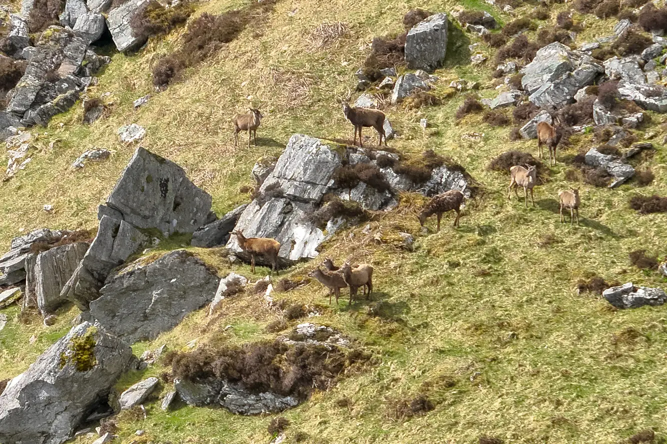
Capabilities of Drone Deer Surveys
Modern drones equipped with high-resolution cameras and thermal imaging sensors can cover large areas quickly and safely. In remote Scottish glens and dense forestry, drones offer aerial perspectives that ground teams simply cannot achieve. Key capabilities include:
- Thermal Imaging: Detecting deer in low light, at dawn or dusk, or in thick woodland cover
- High Resolution Mapping: Capturing detailed aerial images to create geo-referenced data for accurate counts
- Real Time Monitoring: Providing live video feeds to surveyors on the ground, enabling immediate identification
- Cost Efficiency: Significantly reducing the costs compared to manned aircraft or large ground teams
These capabilities allow for more precise, repeatable, and scalable deer counting operations across Scotland’s challenging landscapes.
Problems Faced in Deer Counting
Despite the advances, deer surveys in Scotland face several challenges:
- Harsh Weather: Scotland’s variable climate wind, rain, and fog can ground drones or reduce visibility
- Dense Terrain: Forest cover and rugged mountains can make deer harder to spot without thermal sensors
- Data Overload: Collecting vast amounts of aerial footage requires efficient processing and interpretation
- Regulatory Compliance: Flying drones in certain areas requires adherence to Civil Aviation Authority (CAA) regulations and permissions
Without addressing these challenges, surveys risk becoming inaccurate, delayed, or costly.
Drone Based Solutions
To overcome these issues, drone companies are deploying tailored solutions:
- All Weather Platforms: Rugged drones designed for wind resistance and extended flight times improve survey reliability
- Advanced Thermal Sensors: Dual visible and infrared payloads increase detection accuracy in woodland and low light
- AI and Data Analytics: Automated image recognition software processes aerial data, distinguishing deer from livestock or terrain features
- CAA Certified Operations: Working with licensed pilots ensures surveys comply with UK drone laws, particularly in remote and sensitive habitats
By combining hardware, software, and expertise, drone surveys deliver dependable results that support better wildlife management.
The Future of Deer Surveys in Scotland
Drone technology continues to evolve, with artificial intelligence and machine learning set to make deer detection even more accurate. Multi sensor drones can integrate thermal, LiDAR, and multispectral data for population estimates that are both highly reliable and cost-effective. As land managers face increasing pressure to balance deer numbers with conservation and forestry objectives, drones provide a sustainable and scalable solution.
Conclusion
Deer counting in Scotland is entering a new era thanks to drone technology. By overcoming the limitations of traditional methods, drones offer faster, safer, and more accurate population surveys. For estates, conservation bodies, and forestry managers, partnering with a specialist drone company ensures effective deer management across Scotland’s diverse and often challenging landscapes.