Topographic Survey
Aerial topographic surveys using drone technology provide accurate and efficient mapping
Introduction
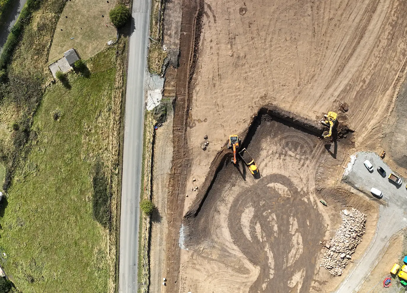
Topographic surveys are essential for construction, land development, mining, and environmental projects. Traditionally, these surveys relied on manual ground crews and costly aerial methods. Today, drone technology for topographic survey has transformed the process—delivering faster, safer, and more precise data collection. By equipping drones with advanced cameras, LiDAR, and GPS systems, surveyors can produce accurate digital elevation models and contour maps in a fraction of the time.
How Drones Enhance Survey Accuracy
Accuracy is critical in surveying, and modern drone mapping for topography provides centimeter-level precision. With Real-Time Kinematic (RTK) and Post-Processed Kinematic (PPK) positioning, drones capture georeferenced imagery that aligns with survey-grade accuracy. This eliminates many of the errors associated with manual measurements, while enabling professionals to analyze terrain data with confidence. For industries such as civil engineering and urban planning, this accuracy ensures reliable decision-making and minimizes costly design errors.
Speed and Efficiency in Data Collection
A major advantage of using drones for land surveying is speed. What once took teams days or weeks to measure on foot can now be completed in hours with an aerial survey. Drones quickly cover large or inaccessible areas, capturing thousands of data points in a single flight. This efficiency reduces labor costs, accelerates project timelines, and allows teams to focus more on analysis rather than manual data collection.
Improved Safety in Challenging Environments
Surveying rugged landscapes, construction sites, or hazardous zones poses significant risks to surveyors. Drone topographic surveys improve safety by minimizing the need for ground crews to physically access steep slopes, busy roadways, or unstable terrain. By flying drones over these areas, surveyors collect comprehensive data without putting staff in harm’s way. This makes drones an indispensable tool for industries prioritizing worker safety.
Versatility of Applications
The applications of topographic drone surveys extend across multiple industries:
- Construction & Infrastructure: Generate elevation models and site plans to guide design and earthworks.
- Mining & Quarrying: Monitor pit progression, calculate volumes, and optimize extraction.
- Environmental Management: Track erosion, watershed mapping, and habitat analysis.
- Urban Development: Support land planning, zoning, and transportation projects.
- Agriculture: Assess field drainage, slope, and land preparation for irrigation systems.
Deliverables and Data Outputs
Drones don’t just collect images—they deliver actionable data. Outputs from aerial topographic surveys include orthomosaic maps, 3D terrain models, contour lines, and volumetric calculations. These digital products integrate seamlessly with GIS and CAD platforms, giving engineers and planners a powerful toolkit for decision-making.
Conclusion
As technology continues to evolve, drones for topographic survey will play an even greater role in mapping the world around us. By combining accuracy, efficiency, and safety, drones provide surveyors and businesses with a competitive edge. Investing in drone surveying solutions means faster projects, reduced costs, and better insights making it clear that the future of topography is aerial.